
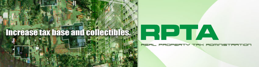
Real Property Tax Administration System
Computerizes and seamlessly intergrates the comprehensive appraisal, assessment, billing, and collection of real property taxes which also covers the RPTA functions and activities of the assessor's and treasurer's offices.

Amellar Revenue Collection System
An affordable, highly customized system application specifically designed for local government unit treasurers to help them organize and consolidate all their collection transactions.


Business Permits & Licensing System
Simplifies business permits and licensing operations by automating the permit application process, assessment of taxes and fees, billing, payment, and liquidation of collections.


Miscellaneous Revenues System
A powerful tool in assessing and collecting miscellaneous revenues that are often neglected such as franchise tax, community tax, professional tax and many others.


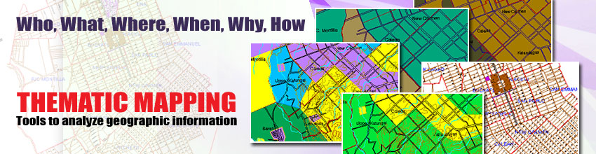
Amellar GIS: Thematic Mapping
A mapping solution that allows users to create different types of maps according to their needs or purposes. It can combine basic information that tells you WHO, WHAT, WHERE, WHEN, WHY and HOW.


Our Products
Amellar GIS: Thematic Mapping
Tools to analyze geographic information
Amellar GIS is a complete mapping tool to get you started with Geographic Information System (GIS). Today, more than a dozen local government units have discovered the powerful features of GIS.
Tax Mapping feature provides powerful and precise engineering-quality digital base maps. From the base maps, users can utilize their existing collection of technical descriptions to automatically generate their first digital tax maps, or update existing tax maps.
System in Action
City Government of Cauayan
With Amellar GIS, the City Government of Cauayan has produces different thematic maps for planning purposes, such as the General Land User Map, Strategic Agriculture and Fisheries Development Zone Map, Soil Map, and many more.
The training included with the purchase of Amellar GIS provides users with the knowledge on how to generate very simple and basic maps to more complex thematic maps.
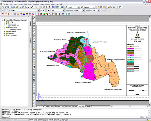
Cauayan City's digital soil map drawn using Amellar GIS customized tools and utilities.
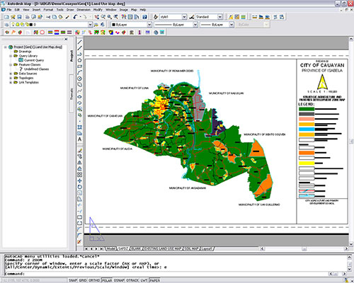
Cauayan City's digital Strategic Agriculture and Fisheries Development Zone Map created using the combined features of Amellar GIS.
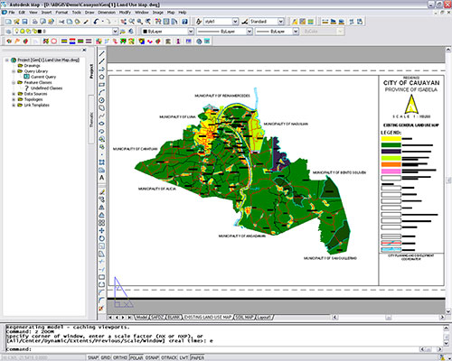
Cauayan City's Existing General Land Use Map.
City Government of Tacurong
Tacurong City also created their Land Capability Map, Soil Map, Strategic Agricultur and Fisheries Development Zone Map, Agro-industrial Development and a Map Network of Protected Areas for Agriculture.
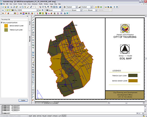
Tacurong City's Soil Map.
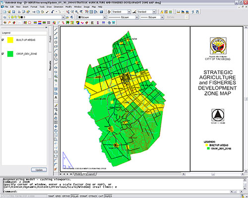
Tacurong City's Strategic Agriculture and Fisheries Development Zone Map.
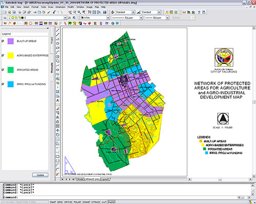
Tacurong City's Network of Protected Areas for Agriculture and Agro-Industrial Development Map.
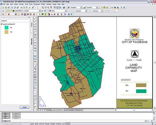
Tacurong City's Land Capability Map.